RideMex, Track 1 Chapala, Chapala to Patzcuaro:
General information
Route rises between 480 and 3,762 meters (1,574 and 12,342 feet)
in elevation over 765 kilometers (475 miles). Don’t be fooled by the thinking “oh, that is such a short distance for one week”. Ridemex has created routes that are truly backcountry so expect scenic, but slow going. It is not the end destination, but the trip that matters. This segment is mostly dirt, with a few semi-rocky areas, and sometimes has small sections of silt going up the national park road to the Nevado de Colima Volcano. The silt is sometimes present during the middle and end of the dry season (February through June). Expect terrains from semi-arid desert to high-altitude pine forests. Temperature variations can be between -3 and 35 degrees Celsius (27 to 95 Fahrenheit), with normal temperatures between 0 and 30 Celsius (32 and 86 Fahrenheit). You will experience cold temperatures on the Nevado de Colima Volcano at night and especially during the winter month nights (November through February).
***We have created a bypass track to go around a more challenging section that is right outside of Tapalpa as you head southwest. As you leave Tapalpa you will be on a paved road heading southwest. Just shy of 6 kilometers (3.7 miles) out of Tapalpa on the pavement there is a turn off onto a dirt road to the right (west). The dirt road winds it way up through a pine forest to a ridge, then drops down through a steep, much more arid valley. This road has always been passable, even on the biggest adventure bikes like the KTM 1290 Super Adventure R and the BMW 1250 GS, but once we had to walk our bikes down one of the steeper parts as it was really washed out. It is a beautiful route but it is also one of the more difficult sections of the RideMex route. If you decided to bypass this section continue on the paved road on the bypass segment.
Recommendations:
- Try the lamb (carne de borrego) in Tapalpa, the region prepares it well.
- If your off road riding skills are sharp, stick to the main route and skip the bypass just southwest of Tapalpa. It is desolate and beautiful country!
- Don’t skip the Nevado de Colima National Park, the park is truly spectacular. The campsites are on the eastern slope with great vistas and the sunrises are often full of color.
- The Barranca de Cupatitzio National Park is a lush garden of eden that has water features that were wonderfully engineered 100 years ago.
- At kilometer 635 there is a turn off for the Paricutin Volcano. In 1943 the volcano was born in a farmer’s cornfield and kept growing through 1952. It was the world’s youngest volcano and was active from its birth for 9 years. It is perfectly conical and its lava flow buried the towns of Parícutin and San Juan Parangaricutiro. The new town of Parangaricutiro is located where the tangent track to get to Paricutin starts. It is a peaceful and beautiful place to camp at the base of the volcano. Our track will take you directly to the most beautiful place to camp just in the pine trees at the edge of a field, with a full view of the volcano to the north. It is about a two hour hike to the rim of the crater and the path has no technical sections. The view at the top of the crater and the surrounding countryside is spectacular.
- Patzcuaro is the epicenter of the Purepecha indigenous community with a lot of history. The main square is beautiful. Visit the Casa de 11 Patios (translated as the house of 11 courtyards), just off the main plaza. The nearby Tzitzuntzan archeological site is located picturesquely on a hill overlooking the Patzcuaro Lake. Isla Janitzio is in the middle of the lake. The boat ride out is pleasant and there is a huge statue of Jose Morelos, who led the Mexican war of independence. You can climb the stairs inside the statue to the very top and enjoy the view of the entire lake.
Fill up on gasoline/petrol at the following places to avoid any range anxiety:
- On the lake shore on Lake Chapala
- Tapalpa
- Ciudad Guzman (search for Pemex on Google maps. After riding down the Nevado de Colima National Park road from the national park on the volcano, turn right onto the paved highway as the GPX file indicates, the Pemex gas station will be a few clicks down the road on your right hand side. After filling up backtrack a few clicks to the RideMex route)
- Uruapan (Avoid getting gasoline in Tepalcatepec unless really needed).
- Patzcuaro
Recommended places to stay:
- Chapala, Lake Chapala: The Villa 1927 Arthotel Boutique Hotel was elegantly designed and is situated right on the lake shore at the edge of the boardwalk.
- Tapalpa: The Casa de Mati Hotel is on the main square and is a place of quaint and rustic beauty with comfortable rooms.
- Nevado de Colima National Park: campsites are nice with little gazebos for relaxing and cooking. There are outhouses, fire rings and plenty of privacy.
- Uruapan: The Mansion de La Barranca de Cupatitzio Hotel has beautiful gardens and rooms and is perfectly situated at the edge of the Barranca de Cupatitzio National Park, right inside the city of Uruapan. The National Park was created in the 1920s and is a must-see site with its lush vegetation and beautiful water features uniquely situated in the middle of a city. The hotel also has a high-end restaurant with great food and a relaxing atmosphere.
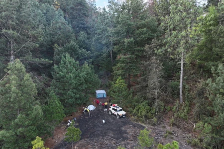
- Camp at the base of the Paricutin Volcano, exactly where the tangent track ends. There is a large field and you can camp just inside the pines with a spectacular view to the north the cone of Paricutin.
- Patzcuaro: The Casa de La Real Aduana is a perfectly restored 17th century hacienda style hotel that is also an art gallery. Restored and run by Didier and Gema for the past 25 years, it is an oasis of home comfort and beauty just a half block off of Patzcuaro’s main plaza.


