RideMex, Track 11, Teotitlán del Valle to Atlahuitzia Waterfall
General information:
This 491 kilometer (305 mile) segment of RideMex is very rugged. It is closer to expedition riding than adventure riding. Again, the route is not particularly technical, but topography is very mountainous and the routes are full of hairpin turns that rise to the ridges and fall into the valleys. A close inspection of this route will show that the track goes north, then east, then south, then east, then north again. It is constantly changing directions as it weaves its way through the sierra between 2,994 meters (9823 feet) and sea level. It will rise 1,000 meters (3,280 feet) and drop down 1,500 meters (4921 feet), then rise up 1,500 meters (4921 feet) and drop back down…. You may notice that some of the points on the graph below touch the X axis on the graph, indicating that the route goes to sea level abruptly. This is of course not possible but because there are part of the route that don’t have roads visible on the map we had to pot their course completely manually. When you plot the points completely manually, their elevation is calculated as unknown,
thus they go to zero.
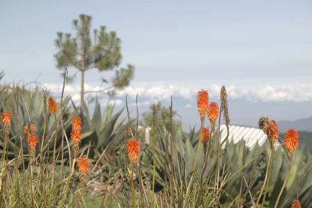
The route is a blast to ride as there will be almost no traffic and you will be in beautiful virgin mountain forests of pine and oak, then into the desert in the Tehuacan-Cuicatlán National Biosphere Reserve, then back into high alpine forests, then back down into subtropical forest in the state of Veracruz. You will go through Zapotec indigenous territory, then Nahuatl territory. You can stay at beautiful cabins the high alpine forests, walk out onto a glass-floored lookout on the side of a cliff, visit the ancient ruins of the Zapotec fortress at Santiago Quiotepec, see wild military macaws flying through the spectacular Sabino Canyon, and be one of just a handful of outsiders to ever see the 100-meter (328 feet) tall Atlahuitzia Waterfall roaring through a gorge in the wilderness of Veracruz. For the rider who loves constant change and the road less travelled, this is the track for you!
Recommendations:
- Teotitlán is a Zapotec town that specializes in artisan wool weaving. It is a nice place to spend a day as the town is pretty and very relaxed. The market is a great place to visit from 7:00 am until 1:00 pm. There are many booths with great breakfast items, great fresh coffee, locally made drinks and high quality, but very inexpensive dishes. When in the area one of our favorite things to do is frequent the market early and spend a few hours there socializing and enjoying the food and drinks. There is also great hiking up El Picacho, the hill beside the town, and into the mountains on the north side. You can ride horses or mountain bike as well. On the backside of the town there is a small lake. While the native language is Zapotec, almost all people in town speak Spanish, and many speak English.
- The glass-floored lookout at Ixtlan de Juarez is fun and you can camp in the pine forests around the lookout. Take the Lookout Tangent at kilometer 80 right at the city of Ixtlan de Juarez to get up to the lookout. It is easiest to follow the tangent track northwesterly and then circle around in a clockwise fashion to get back down to the main track.
- The Sierra Juarez is particularly wild and beautiful. Despite Mexico being the 13th largest country in the world and 70% mountainous, there are very few large, intact forests remaining. The Sierra Juarez from about kilometer 135 to 210 is an intact mountain forest with almost no human habitation visible along the track. Enjoy this ride!
- The forests of the Sierra Juarez peter out into La Cañada. At kilometer 226 you will be at a bridge at the bottom of a valley that you just zigzagged down into. As you climb back up toward their ridge lines you will see La Cañada off to your left. Tucked away in the rugged Sierra Mazateca of northern Oaxaca, La Cañada is a breathtaking region of deep canyons, misty mountains, and lush cloud forests that offer an unforgettable riding experience. Winding dirt roads carve through steep cliffs, remote indigenous villages, and cascading waterfalls. The area is rich in Mazatec culture, known for its traditional healing practices, ancient caves, and mystical landscapes. The RideMex track goes along La Cañada leading you into the Teohuacan-Cuicatlan Biosphere Reserve.
- Santiago Quiotepec is a small gem of a town that you only discover by getting off the beaten path. A local guide can take you on a hike to the ruins of a centuries-old pre-Hispanic Zapotec fortress. The fortress is located on a hill at the confluence of two rivers making it a perfect location for controlling commerce. There is a magnificent view of the canyon and the surrounding landscape.
- Hire a guide in Quiotepec to take you to the Sabino Canyon, or as some locals are now calling it, the Alas Verdes Canyon (Green Winged Canyon). There you will see yet another sight unlike any other you could experience in the whole rest of North America. The military macaws live and nest in the canyon that provides them a refuge from the endless onslaught of humanity that has put their species in such risk of extinction. In the morning the long feather blue, green and red macaws fly out of the canyon to their feeding grounds and then around sunset they can be seen flying back to their nests. It is a glorious sight to see such a spectacular landscape embellished by the flight and call of such gorgeous parrots.
- At kilometer 393 you will see the Puente de Fierro Waterfall literally meaning the iron bridge waterfall because of the iron bridge that was build to allow you to walk over the river to the falls. It is right along the road and is a refreshing place to take a break in the spray of the falls among the large trees.
- The Atlahuintzia Waterfall was one of those great discoveries that backcountry riding on the most remote tracks you can find allows you to stumble upon. We came upon a landslide while creating Ridemex and realized we were going to re route, but decided to take a walk and a break before backtracking. We could hear a gentle roar in the distance and walked past the landslide that direction. A half kilometer from the waterfall it was “raining”. The falls created a thunderous roar in the valley and a rain was falling from the spay of the falls as there had been a heavy rain the night before and the river was even more powerful than usual. It was truly a sight to behold. The fall has a different personality depending on the time of year. It can be a roaring, dangerous monster eroding and washing away anything weak in its path, or a gentle giant with good swimming during the dry season. Drive down the Atlahuitzia Falls tangent to see it. It is well worth the extra kilometers, even though you have to backtrack.
Fill up on gasoline/petrol at the following places to avoid any range anxiety:
- At the gas station close to Teotitlan. If you ride out the main road leading out of Teotitlán down to the highway and make a left onto the highway you will see the gas station a few minutes down on the left side.
- At the Ixtlan de Juarez gas station, right where the glass-floored lookout tangent turns off to the right. This gas station will be the last one for about 200 kilometers and for a good long section of the route ahead there won’t be any homes, so make sure you get a full tank and if needed bring some fuel in your bladder or bottles.
- The gas station right before San Juan Bautista Cuicatlán, kilometer 281 on the track.
- After San Juan Bautista Cuicatlán you will come to the town of Santa Maria Tecomavaca and head a serpentine route into the high mountains. There won’t be any gas stations for the rest of the track, about 207 kilometers (129 miles), but some of the towns sell gasoline at local stores.
Recommended places to stay:
- Teotitlan del Valle has two places to stay of particular interest. One is Dixza, a home live-in, cultural experience where you can stay with a Zapotec family, see how they weave their traditional rugs and how they raise their farm animals. Go to https://dixza.com/ to reserve a room via AirBnB or contact them directly. You can also stay at Casa Montagnola.
- You can camp in the forest up by the glass-floored look out at Ixtlán de Juarez. It is called the Mirador de Cristal de Ixtlán de Juarez in Spanish.
- At kilometer 99.7 on the track there are cabins on the right hand side of the road, across the street from a restaurant called El Oso. The cabins are just 8 kilometers outside of Ixtlán de Juarez. The cabins are comfortable and positioned inside a forest that has nice hiking trails. There are all kinds of steel cables with rungs for canopy tours. It is no longer officially in use but no one seems to care what you do there. Most of it is in good condition and we had fun climbing up and exploring the trees. Take note that society in Mexico is not litigious so you are often free to do what you please wherever you go, but you and only you are responsible for your actions. In other words, people don’t tend to have insurance for any accidents on their property. You are responsible for what you do, not the owner of the property. The restaurant across the street form the cabins has good food.
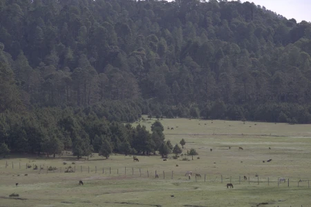
- The Atepec Cabins are at kilometer 113.5 (mile 70.5). The cabins are situated at the edge of high mountain pastureland in a very idyllic setting: green grass, beautiful pines, cool mountain temperatures….
- At kilometer 116 (mile 72) there is a turn off to the right onto a dirt road that leads up into a forest of old growth trees. It is a great place to camp as the road is deadened and there is no through traffic. It is rare to find such huge trees anywhere close to human habitation, so it is a rare find. The place is very peaceful and beautiful. This spot is just 2.5 kilometers (1.5 miles) after the Atepec Cabins at kilometer 113.5 (mile 70.5)).
- After the aforementioned two spots you will go through an almost-200 kilometers section before you come to the next gas station, much of which is wilderness. There are many places to camp and there are streams crossing the road at a different spots if you want to set up your tent close to fresh water. There are no hotels or cabins in this section.
- Stay at the community-created hotel in Santiago Quiotepec. The rooms are nice, the price is good, the town is very quaint, and it is the only place to stay! You can hire a guide to take you to the Zapotec fortress and the Sabino Canyon (Ala Verde Canyon) to see the highly endangered military macaws. It is well worth the time! The canyon is spectacular and the large macaws are beautiful with their green, blue and red plumage.
- At kilometer 436 you will cross the river Petlapa. There is a descent spot for camping there.
- Camp or stay at the cabins at the Atlahuitzia Falls at the very end of the track. The 100 meter (328 foot) falls and the lush rugged landscape are magnificent. To stay in the cabins you will mostly likely have to talk to someone in the town before you get to the falls as the spot is visited so infrequently (except during Easter), that there is usually no staff on hand. You can camp without getting permission.


