


RideMex, Track 12, Atlahuitzia Falls to Ixtacamaxtitlan
General information:
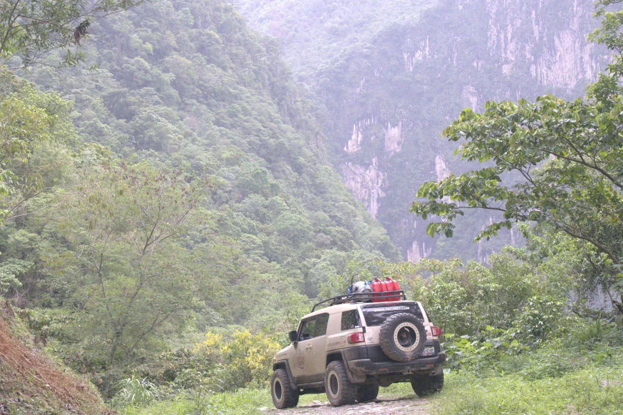
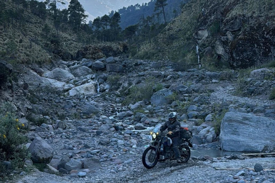
This track has numerous spectacular highlights as most segments of the RideMex TransMexico Trial do. It starts at the towering 100-meters (328 foot) Atlahuitzia Falls in the state of Veracruz, passes through indigenous villages among green mountains to the city of Orizaba in the foothills the might Orizaba Volcano, Mexico’s highest peak at 5635 meters (18,491 feet), winds its way to the beautiful city of Coatepec among the coffee plantations of the highlands, then meanders across the high plateau to the the centuries old town of Ixtacamaxtitlan with its ancient churches and stately ruins. Track 12 is 478 kilometers (297 miles) long and rises and falls between 181 and 4268 meters (594 and 14,000 feet). Check out the elevation chart below. You may notice that some of the points touch the X axis on the graph, indicating that the route goes to sea level abruptly. This is of course not possible but because there are part of the route that don’t have roads visible on the map we had to pot their course completely manually. When you plot the points completely manually, their elevation is calculated as unknown, thus they go to zero.

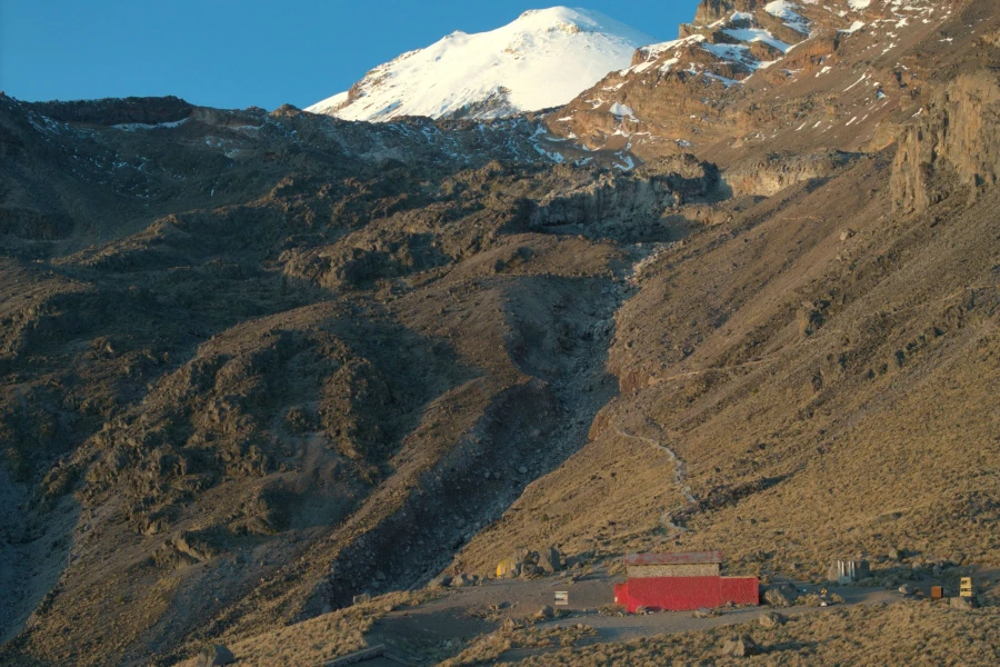
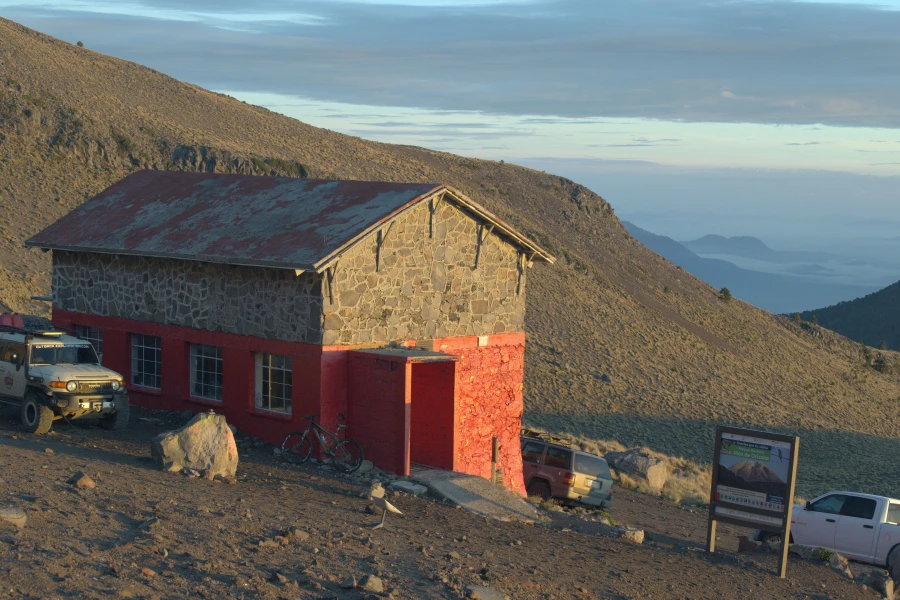
The temperatures along almost the entirety of the route are quite pleasant between 13 and 29 Celsius (55 and 85 Fahrenheit), but day time temperatures at the very top of the route, the highest point of vehicle travel up the Pico de Orizaba volcano, can be as low as -5 degrees Celsius (23 Fahrenheit) on an extremely cold day in December or January although normal daytime temperatures are around 5-15 degrees Celsius (41 to 60 Fahrenheit). Check the forecast before you ascend the volcano regardless of the time of year as high mountain weather can be dangerous if you are not well prepared. Having given these warnings, don’t miss the volcano unless you get altitude sickness or have some other real reason to not go, the route is spectacular and the views are some of the best in North America. The riding is so amazing on the volcano, and the landscape is so beautiful, we made an additional RideMex route that is labelled Track 12A, Circumnavigate the Pico de Orizaba Volcano, that circumnavigates the entire volcano. As you circumnavigate the volcano you will ride through pine forests, potato and oat fields, see farmers working their fields with oxen, cross streams and see unforgettable vistas throughout the states of Puebla and VeraCruz as this behemoth lies in both Mexican states. There are unofficial places to camp throughout the route. You will glimpse the imposing snow covered peak at 5,631 meters (18,491 feet) when the cloud cover breaks. The Large Millimeter Telescope is a binational project between Mexico and the US. It can be see from the route on the southwest slope of the volcano, not far from the Fausto Gonzalez Refuge, where the mountaineers stay and where you can sleep too.
Recommendations:
- Enjoy the imposing Atlahuitzia Falls. They are infrequently visited by outsiders.
- Spend at least a day in Orizaba, the city is not well known in Mexico yet it has a beautiful river walk and many parks. The river is clean, extremely unusual for an urban river in Mexico! The city won the Golden Broom award as the cleanest city in Mexico and continues the proud tradition of urban cleanliness. You can take the cable car up to the Cerro Borrego and see views of the city and the Pico de Orizaba Volcano. In the city center, visit the Iron Palace, in Spanish the Palacio de Hierro, that was designed by Gustave Eiffel’s company. Yes, the same Frenchman who designed the Eiffel Tower in Paris. We had intended to spend but one night there. However, we found it so pleasant and interesting we ended up spending two full days and three nights in the city.
- Don’t miss the Pico de Orizaba Volcano. Standing at 5,636 meters (18,491 feet), Pico de Orizaba is the highest peak in Mexico and the third highest in North America, making it an iconic destination for adventure riders. The rugged off-road ascent to its high-altitude refuges, such as Refugio Piedra Grande (4,260m) and Refugio Fausto González Gomar (4,600m), offers challenging terrain, technical rocky climbs, and breathtaking views. Riders will navigate remote mountain trails, volcanic landscapes, and extreme elevation changes, pushing both man and machine to the limits. With its combination of high-altitude adventure, stunning scenery, and raw off-road terrain, Pico de Orizaba stands as one of the most exhilarating ADV destinations in Mexico. 🏍️⛰️🔥
- Visit the Cascade de Texolo outside of Xico. There is a turn off tangent at kilometer 344 that goes left to a gas station, then turns left again to get to the falls. It is a pretty place with an old bridge made by some US engineers years ago, and hiking trails through lush forest along the river.
- Stop or stay in Coatepec, just north on the route from the Cascade de Texolo. It is a pretty colonial architecture town known as the coffee capital of Mexico. The region produces a lot of North America’s best coffee.
- Tucked away in the rugged highlands of Puebla, Ixtacamaxtitlán is a hidden gem for adventure riders seeking off-the-beaten-path exploration. This remote region offers a mix of winding dirt roads, challenging mountain trails, and stunning panoramic views of the Sierra Norte de Puebla. With its rich pre-Hispanic history, riders can discover ancient ruins, colonial-era churches, and traditional indigenous communities that preserve centuries-old customs.
Fill up on gasoline/petrol at the following places to avoid any range anxiety:
- Zongolica: the route goes right by the gas station in the middle of the big town.
- The city of Orizaba has a few gas stations.
- Coscomatepec de Bravo: the route goes right by the gas station.
- The previous two locations are the only places that there are gas stations on the entire route on or close to the Pico de Orizaba Volcano. Make sure you fill up at both of these locations as there won’t be another gas station until you get to Xico. Range anxiety is one stress factor you can eliminate by filling up whenever there is a gas station in remote areas, so we stick by this rule.
- Fill up in Xico.
Recommended places to stay:
- Camp or stay at the cabins at the Atlahuitzia Falls at the very end of the track. The 100 meter (328 foot) falls and the lush rugged landscape are magnificent. To stay in the cabins you will mostly likely have to talk to someone in the town before you get to the falls as the spot is visited so infrequently (except during Easter), that there is usually no staff on hand. You can camp without getting permission.
- The Hotel del Rio in Orizaba is a your basic hotel, but it is located right along the middle of the river walk. Being that the river walk is really the highlight of the city, we found it the best place to stay. Hotel del Rió is also just a few blocks from the beautiful Iron Palace and the city market. If you would like a fancier hotel with more amenities the Hotel Mission Orizaba has a nice courtyard and pleasant niches to relax in and is pretty close to everything too. Both hotels have parking for motorcycles.
- On the Pico de Orizaba Volcano there are many places to camp. You can also stay at either the Piedra Grande mountaineer hut on the north side of the volcano or the Fausto Gonzalez Gomar mountaineer hut on the south side of the volcano. This is where the mountaineers tend to stay when they are going to attempt to summit the volcano, but anyone can stay there. Remember nights are cold on the volcano.
- The Hotel Posada Coatepec is an elegant colonial style hotel in Coatepec, Veracruz. It is quiet, has parking on site, a few beautiful courtyards, an delicious, huge breakfast included in the price of the room, and is located just one block from the main square. Casa Posada San Jeronimo is quiet, clean and nice, but less grandiose. It’s room prices are about half the cost of Hotel Posada Coatepec. At the time of this writing the rooms were about US $45 per night at San Jeronimo and about US $85 at Posada Coatepec for two people.
- Outside of Coatepec, back up in the high mountains there are places to camp between kilometers 370 and 385, around the small town of Ingenio del Rosario.
- Stay at the Hotel Razo Ixtacomaxtitlan. It is the only place to stay in Ixtacomaxtitlan where Track 12 ends and it is nice and inexpensive. The rooms are comfortable, it has a nice courtyard and is located right on the town’s main park with a great view of the surrounding mountains. East northeast of the town high up at the top of the mountain is an overlook and a good camping spot. At kilometer 486.5 there is a RideMex tangent that leads up to the camping spot. This tangent is right before the town of Ixtacomaxtitlan.
RideMex, Track 12A, Circumnavigate the Pico de Orizaba Volcano
General Information:
Track 12A is an add-on to Track 12. If you are a more experienced rider and want a full-blown adventure, circumnavigating the entirety of the Pico de Orizaba Volcano, this is the track for you. Our original plan was to create a route up to just one of the mountaineering huts, the highest points you can ride to. But, after experiencing the beauty of the volcano we thought it was worth the time and effort to create a beautiful route going around the entire volcano and visiting both of the roads highest points at the Fausto Gonzalez Gomar (south side) and Piedra Grande (north side) mountaineering huts. The most difficult part of this track is the part between Nuevo Jacal and Piedra Grande, the 15-kilometer section between kilometer 128 and 143. While much of the volcano is a national park and technically is protected, there is little enforcement of this protection so there is rampant logging on the northeast side of the volcano. Mules and horses drag logs down the road. The constant misuse of the road with no one doing maintenance, as well as the deforestation causing more erosion has created a challenging, but passable (at least at the time of writing) dirt track. This may sound discouraging, but the landscape is still beautiful and the route is fun if you are a good enough rider. If you find yourself getting in over your head you can just turn around. You can sleep at either of the mountain huts, or camp just about anywhere you please along the route. There are streams and high mountain pine forests with wonderful places to camp. Give yourself a minimum of two full days to do the circumnavigation. Track 12A is a 228 kilometer (142 miles) that rises between 1201 and 4557 meters (3940 and 14,950 feet). While it may seem like a short distance to ride, the roads rise and fall and twist and turn and are about 90% improved and unimproved dirt. Some sections are technical, especially on the aforementioned 15 kilometers section on the northeast side of the volcano. If there have been heavy rains in the past 24 hours you may want to avoid this section or at least walk part of it before riding into it. Again, our job is only to give you as much information as possible to make your trip a positive, life-enriching experience without unnecessary risk. We don’t want to discourage you. If you are a capable rider with lots of experience, go for it and have fun!