RideMex, Track 6, San Jose del Pacifico to Union Juarez Tacana
General information:
Part 6 of RideMex is by far the longest section so far at 1076 kilometers (669 miles). It starts of in San Jose del Pacifico in the alpine pine forests at 2,756 meters (9,042 feet) drops down to sea level for about 700 kilometers (435 miles) and then rises up to 2,622 meters (8,602 feet) on the slopes of the Tacana Volcano right on the Mexico-Guatemala border. As the costal section is very flat you can make good time. The elevation graph shows this well:
This is one of the rare sections of the RideMex route that has any real flatlands. Mexico is the earth’s thirteenth largest country and is 70% mountainous, so there are A LOT of mountains in the republic. Not only is the country mountainous, but the topography is particularly rugged. There are frequent extreme ascents and descents making for beautiful scenery and many microclimates with different ecosystems containing unique flora and fauna, but the going is much slower than many are accustomed to. On the coast the route moves northeastward, then southeastward into the subtropics of Chiapas. The rainy season is from May through the end of October, possibly mid-November in Chiapas and it rains a lot for a few hours, almost daily, usually between 1:00 pm and 8:00 pm. The mornings tend to be a good time to ride unless their is a tropical storm sitting over the area and there is what locals call a “temporal”, a steady drizzle that on rare occasions may go on for days. The route goes through large mango orchards along the coast of Oaxaca and Chiapas. There are dozens of varieties of mango in Mexico, but you will mostly see Atahulfo, Petecon and Manilia mangos in this region. They are delicious and if you happen to ride through during mango season between February and June, feel free to pick up some from the ground under the trees. The orchard owners don’t care about the ones on the ground. They will just rot there. This is also cattle and horse country so expect to see a lot of quarter horses and Zebu cows. If you pay attention you will find a lot of tropical fruit like bananas, plantains, starfruit, oranges, lemons, rambutan, Florida avocados (the really rare ones weighing up to 1 kilo or 2 pounds), papause, chicozapote, watermelon and many other varieties. It is a fruit lover’s paradise. The weather around San Jose del Pacifico, where the route starts, is quite nice as it is on the Tacana Volcano on the Mexico-Guatemala border. On the coast, November through February can be quite pleasant, but expect hotter temperature throughout the rest of the year. For the winter months temperatures will be between 21 and 32 degrees Celsius (70 and 90 Fahrenheit) with high humidity. April and May are extremely hot and muggy as it is the end of the dry season and humidity is moving in as it wants to start raining, but isn’t yet. Once the steady rains start in June, the weather is much nicer again as the heavy showers cool things off.
Recommendations:
- San Jose del Pacifico is a wonderful place to enjoy very temperate weather, hike, do a temazcal (an indigenous sweat lodge ceremony), enjoy the hanging bridges and views, and eat good food. It is at 2,756 meters (9,042 feet), and being at lower latitudes, this makes for an ideal climate among the large pines.
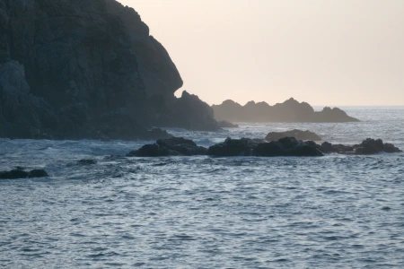
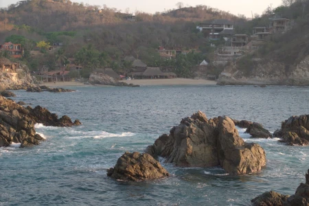
- Puerto Angel and the surrounding area has beautiful beaches. In place the hills come down to the ocean creating little coves where the valleys feed into the ocean. In places there are cliff faces with great views. Our favorite spot is exactly where the Puerto Angel segment of the track ends, in Estacahuites. There is a beautiful cove with a sandy beach. There are reefs teeming with fish a short swim off the sandy beach. We recommend staying with Mikey Galvan at Cabañas Los Colibries (it is called Collieries Cabins, but they offer hotel rooms, not cabins). It is safe to park your bikes in his parking lot, the nice air-conditioned rooms look out over the cove, and Mikey treats you like family. It is a three minute walk down to the water’s edge. You can rent snorkeling gear right on the beach. You can call 958 219 0311 to reserve a room at Cabañas Los Collieries, or use AirBNB.
- The coast is interesting and has a few notable beaches like Puerto Arista and Boca del Cielo. At kilometers 618 on the route, close to Tonalá, there is a turn-off segment for the Puerto Arista Beach. About 13 kilometers southeast of Puerto Arista Beach is Boca del Cielo Beach. There are hotels there or you can camp.
- At kilometer 783 (mile 486.5) there is a tangent that goes northeast out of Mapastepec to the little town of Costa Rica on the slopes of the Western Sierra Madre Mountains. At the back end of town you can camp along the river and swim in the beautiful swimming holes. There is a fair-sized parking lot at the trail head. So you can camp by the parking lot or farther up along the river. The weather is cooler there a bit higher up and under the shade of the large trees. There is also plenty of water in the pristine river year round. The community grows coffee and cacao for its subsistence and the people are very friendly every time we go there.
- At the same kilometer 783 (mile 486.5) there is a tangent that goes northward to the small town of 3 de Mayo, so called because this was the date it was founded on. The Triunfo Biosphere Reserve is along the top of the mountains you see to the north. If you would like to be one of the few foreigners to access the reserve and view wild spider monkeys and possibly see other animals in this biodiversity hotspot you can contact Nelson Guzman at +52 918-151-0047. He is a good guide but only speaks Spanish. We walked for 17 hours into untouched wilderness and saw two troupes of wild spider monkeys as well as Jaguar and tapir prints in additional to many bird species including one giant eagle. This area of southern Mexico is rarely visited by foreigners so you can have a truly unique experience. There is good camping up at 3 de mayo as it is along a river in a subtropical forest.
- At kilometer 1007 (mile 626) there is a turn off to Agua Caliente, a thermal (hot) water waterfall with places to camp.
- The route ends at Casa Morayma, a wonderful hotel with great rooms and views. You can see down to the Pacific Ocean or up to the top of the volcano that rises up to 4,060 meters (13,320 feet). This height looks particularly impressive when it is close to the ocean and you can see how the continent jutted up into the sky all the way from sea level. The weather is very pleasant at 1,281 meters (4,203 feet) and the surrounding landscape is quite lush. This entire region grows coffee and cacao. There is a hiking trail that you can take to the summit of the volcano and no special climbing gear is needed. You will however need cold weather and rain gear as well as food and water as it is a good 15 hour hike up and back down. From the head of the trail to the top you will hike up just under 3,000 meters (9800 feet), so the hike is no joke. Despite being quite far south the high elevation makes it quite cold at night. When we went we built a roaring fire to keep warm and slept bundled up inside our bags. You will cross the Mexico-Guatemala border multiple times as you climb, but you won’t need your passport or have to do any paperwork as you can pass freely. If you don’t want to hike up the volcano to its summit you can take a much shorter hike into Guatemala. Down at a lower elevation on the same road that Casa Morayma is on there is the town of Santo Domingo, an old German coffee-growing settlement that preserves some of their original German-like architecture. It is well worth exploring the area and spending a few days enjoying having made it to the most southern part of the route and to Guatemala! Congratulations! You have done what few have ever done!
Fill up on gasoline/petrol at the following places to avoid any range anxiety:
- In San Pedro Pochutla, right as you hit highway 200, there is a gas station on the corner.
- After you leave Puerto Angel and do the back country route you will hit highway 200, the PanAmerican Highway, again. There are places to fill up along the way as is needed.
- Make sure you fill up around Juchitan as you will be going into a longer segment of backroads.
- Fill up again in Mapastepec.
- Then in Belisario Dominguez, before you head toward the more wild country up the Tacana Volcano.
- Before you arrive at Casa Morayma in Union Juarez, just 19.6 kilometers (12.2 miles) before the hotel, is the Faja de Oro gas station. Midway between the gas station and Casa Morayma is Santo Domingo, the former German coffee-plantation settlement. There is a German-like wooden building in the center of town with a good restaurant and views. It is worth a stop, or come back later after you have rested up.
*** Again, remember that when you are off the beaten track locals tend to have gasoline they are willing to sell you at the small stores or even at their homes. It will be regular gasoline. If you happen to be running low, as long as there is some habitation, you should be able to find fuel.
Recommended places to stay:
- In San Jose del Pacifico you can stay at the Campanario Hotel & Spa, Bostel Rancho Viejo or the Boutique Hotel and Cabins as well as a few other places. The first three are comfortable and cozy. It is easy to find a camping spot and the weather is ideal for being outdoors.
- Puerto Angel and the surrounding area has beautiful beaches. In place the hills come down to the ocean creating little coves where the valleys feed into the ocean. In places there are cliff faces with great views. Our favorite spot is exactly where the Puerto Angels segment of the track ends, in Estacahuites. There is a beautiful cove with a sandy beach. There are reefs teeming with fish a short swim off the sandy beach. We recommend staying with Mikey Galvan at Cabañas Los Colibries (it is called Collieries Cabins, but they offer hotel rooms, not cabins). It is safe to park your bikes in his parking lot, the nice air-conditioned rooms look out over the cove, and Mikey treats you like family. It is a three minute walk down to the water’s edge. You can rent snorkeling gear right on the beach. You can call 958 219 0311 to reserve a room at Cabañas Los Collieries, or use AirBNB. There are many others places to stay here and on the neighboring beaches. It is a tourist area so there are many accommodations. You can also pay a small fee to camp on the beach.
- Juchitan is a good place to stop off and spend the night. There is the Hotel Santa Cruz with a pool as well as a few others.
- Puerto Arista has hotel like the Luxury Palms Hotel and Restaurant, the Awa Hotel Boutique and Spa, or the Hotel Arista Bugambilias right off the beach. You can also camp on the beach.
- Camp in the little town of Costa Rica under the trees along the pristine river. Take the tangent from Mapastepec northeast.
- Camp in the little town of 3 de Mayo before going on a jungle hike to The Triunfo Biosphere Reserve. Take the tangent northward from Mapastepec.
- Camp at Agua Caliente, the short tangent that cuts off at kilometer 1007 (mile 626), by the thermal waterfall.
- Stay at Casa Morayma in Union Juarez, where Track 6 ends. Morayma is a great host and has created a really nice hotel with a roof terrace that has a view of the Tacana Volcano as well as the Pacific Ocean and surrounding forests and villages. Eat at Donde Morayma. It is a cozy little restaurant just two blocks from the Hotel with good staff, beautiful plants and good views. Her coffee and pastries are really tasty. Both the hotel and restaurant are decorated with many wonderful pictures that her daughter has taken around the world. Morayma or the workers can point you in the right direction to hike into Guatemala or up to the summit of Tacana, or supply you with a guide. Tacana is right on the international border, so half the volcano is in Mexico and the other half is in Guatemala. Congratulations, you made it to Guatemala on RideMex!


